
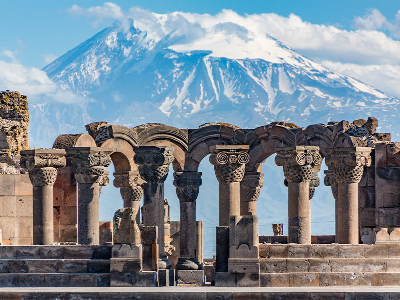
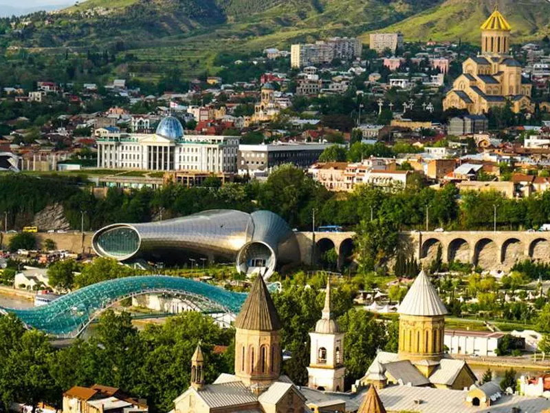
Greater Iran was once one of the largest empires in the world. Interestingly, this empire included many of our present-day neighboring countries such as Turkey, Armenia, Afghanistan, Bahrain, and others, and it was considered the eastern seat of government. Over the years, with the emergence of multiple kings, Iran’s territory became narrow, and in each political and military struggle, a part of Iran was plundered to end the dangers and establish security. The current lands of Iran constitute only 30% of what used to be Greater Iran. The ancient Greater Iranian Empire included these areas: Aran and Shirvan, Armenia, Georgia, Dagestan, North Ossetia, Chechnya, Ingushetia, Herat and Afghanistan, parts of Balochistan and Makran, Turkmenistan, Uzbekistan, Tajikistan, parts annexed to Kazakhstan, parts annexed to Kyrgyzstan, the Emirates, Bahrain, Qatar, and Oman. In the following article from Eligasht, you can obtain detailed information about the disintegration of Greater Iran how and when these regions separated from the Greater Iranian Empire.
Book Iran Air flights from London to Tehran and Tehran to London with Eligasht UK:

The Disintegration of Greater Iran in the Golestan Treaty
On 20 Mehr 1192 SH (October 12, 1813 AD), Iran was deeply involved in a long and erosive war with Russia. The Golestan Treaty was imposed on Iran during the reign of Fath Ali Shah Qajar at that time due to the damages of the war and the massacres of the Iranian people, soldiers, and Russians. According to the Golestan Treaty, fourteen states of the Caucasus were separated from the rest of the common territories and ceded to Russia. The fourteen states and provinces that were separated from Greater Iran in the Golestan Treaty are as follows: Ganja and Karabakh states, Shaki, Shirvan, Quba, Darband, Badkubeh, Dagestan, and Georgia, Mahall-e Shoor-e Gol, Ashuq-Bashi, Gruziye, Mingrelia, and Abkhazia. In addition to these provinces, part of the Talysh land also came under Russian occupation, and unfortunately, the 100% Iranian sovereignty over the Caspian Sea waters was also undermined as a result of this transfer.
The Turkmenchai Treaty
The Turkmenchai Treaty is one of the most disgraceful treaties in which significant parts of the Greater Iranian Empire were separated from this land. This treaty marked the end of Iran’s sovereignty over the Caucasus. Thirteen years after the end of the 10-year Russo-Persian War due to the Golestan Treaty, the war between these two countries resumed when Fath Ali Shah Qajar was still firmly in power. The second phase of the Iran-Russia wars was essentially a summary of the first war, but this time the Russians emerged victorious with greater determination. With the Russian army reaching Tabriz, Fath Ali Shah Qajar feared the entry of troops into Tehran, and for this reason, on the 1st of Esfand 1206 SH (February 21, 1828 AD), he sat down at the negotiation table again.
Fath-Ali Shah Qajar requested immediate peace from the Russians, and the Treaty of Turkmenchay marked the end of the wars. According to the provisions of this treaty, three other Caucasian states, namely Erivan, Nakhchivan, and other parts of Talysh, came under Russian control. Iran’s sovereignty over the Mazandaran Sea became even more limited, and the Iranian people reluctantly accepted capitulation (consular jurisdiction). As a result, other important and vital parts of Greater Iran were separated and fell into the hands of the Russians.
Zahab Treaty
The Zahab Treaty, also known as the Treaty of Qasr-e Shirin, was an agreement signed in Qasr-e Shirin on May 17, 1639, between the Safavid Empire of Iran and the Ottoman Empire. This treaty resulted in the separation of Turkey from Greater Iran. At the time, after the Battle of Chaldiran, the international Zahab Treaty or Qasr-e Shirin Treaty was signed by the Safavid and Ottoman Empires. It can be said that this treaty brought an end to the 150-year war between Iran and Turkey. As part of the agreement, Iran gained control over southern Transcaucasia, including the joining of Erivan, while the territories between the two rivers (including Baghdad) went to the Ottomans. However, this treaty did not end the border disputes between Iran and the Ottoman Empire. The exact demarcation of borders between these two countries was carried out during the establishment of the Republic of Turkey (after World War I and the collapse of the Ottoman Empire in 1918) among Iran, Turkey, and Iraq.

Paris Agreement and the Partition of Herat from Greater Iran
In 1857, during the reign of Mohammad Shah Qajar, Iran and Britain were engaged in a fierce war over the ownership of Herat. British forces occupied parts of southern Iranian cities such as Bandar-e Khorramshahr, Bushehr, and the southern islands in the Persian Gulf, forcing Mohammad Shah Qajar to negotiate. According to the harsh Paris Treaty, accepted by Farrokh Khan Ghaffari, Iran ignored its claim to Herat, and Herat joined Afghanistan in 1863. As part of the same treaty, Iran officially recognized the existence of a country called Afghanistan. Under this treaty, Iranians agreed to withdraw their forces from Herat, apologize to the British ambassador upon his return to Iran, and accept a colonial trade agreement.
With this treaty, the neck of the Iranian nation was officially placed under the sword of the British. Additionally, Iran committed to granting certain territorial concessions to the Sultanate of Muscat, which was considered a British ally at the time. Britain also committed not to harbor any opponents of the Shah in its embassy. Thus, Herat was separated from the Greater Iranian Empire through this harsh treaty.
The Separation of Makran and Balochistan
After Iran’s defeat in the Caucasus wars and the turmoil in Herat, as well as the secession of several territories from Greater Iran, unrest erupted in the regions of Makran and Balochistan. At that time, Imam Mohammad Shah Qajar was able to temporarily calm the situation through force and intimidation. It was during this time that the British government sharpened its teeth to gain control over these vast territories, which extended from the Gulf of Guadar to the Sind River. British officials, under the pretext of guarding the telegraph line from Bushehr to India, signed a treaty with Khan Kalat.
The British government granted Khan Kalat certain rights and bestowed upon him the title of Amir Kalat. Despite opposition and resistance from some statesmen to this matter, Naser al-Din Shah finally surrendered and signed the border demarcation treaty on 13 Shahrivar 1250 AH (September 4, 1871 AD). Following the acceptance of this treaty, the British government occupied the mentioned region militarily and named it British Balochistan.
The Separation of Sistan from Greater Iran
After occupying Balochistan and preventing Russian expansion into the remaining lands of Greater Iran, the British government took action to seize the vast province of Sistan, which held significant strategic importance. The British government appointed Amir-e Kabul to attack Iran. By doing so, they were able to persuade the weakened Iranian government to accept the British government’s authority in determining the borders of Sistan. As a result of this process, in 1251 AH (1872 AD), the lands of Sistan were divided into two external and internal regions, and the smaller internal portion, with an area of just over 1,500 square kilometers, remained with Iran, while a significant part of Sistan was separated from Greater Iran.
The Separation of Sistan, the Akhal Treaty
The Qajar government was one of the weakest governments in the history of Iran. The unprecedented disunity in the foundation of this government provided the grounds for the separation of many parts of Greater Iran. After the separation of Afghanistan and its recognition as a separate country from Iran, the routes passing through the territories of Khwarazm and Fararud were closed off to the Iranian government. Consequently, the physical connection with “Iran Vizh” (regions such as Bukhara, Samarkand, Fergana, etc.) was cut off.
The Russian government, based on the Peter Charter, launched a military attack on the territories of Khwarazm and Fararud. Between the years 80-1860 AD, this government crushed the resistance of the people of these territories and the local princes affiliated with Iran and occupied all the lands of Khwarazm and Fararud. Following this collapse and the Russian domination over the territories, the Iranian government was forced to sit at the negotiating table on 23 Azar 1260 AH (December 14, 1881 AD) and sign the Akhal Treaty. In this treaty, Iran guaranteed to turn a blind eye to its governance rights over the territories of Khwarazm and Fararud.
related post
The Avicenna mausoleum in Hamadan, the Most Famous Iranian Physician in the World.
Tang-e Tamoradi Waterfall, a Natural and Historical Attraction in Yasuj
The Last Arrow of the Disintegration of Greater Iran in the Treaty of Friendship
Following the rise of the Bolshevik government in Russia and the breaking of the widespread resistance of the oppressed people of Tatars in the Caucasus, Khwarazm, Fararud, and other areas, the Red Army, occupying the city of Rasht and other parts of Gilan, put pressure on the government of Iran to transfer the bloody legacy of the Tatars to the “New Tatars.” Meanwhile, when the city of Rasht and large parts of Gilan were under the occupation of the Red Army and the fear of their attack on Tehran severed the lifeline of the Iranian government, the government of Iran signed the Treaty of Friendship. With this signing, all the land of the Caucasus, the lands of Khwarazm and Fararud, and a part of Iran’s sovereignty over the Caspian Sea and other areas were transferred to the “Red Tatars.”
Final words
The territory of Iran in the past was vast and diverse, encompassing a rich tapestry of cultures, languages, and landscapes. From the ancient Persian empires to the Islamic period and beyond, Iran’s borders expanded and contracted, influenced by historical events, conquests, and geopolitical shifts. Iran’s historical territory includes diverse regions such as Azerbaijan, Kurdistan, Balochistan, Khorasan, Gilan, and many others. Each of these regions contributed to the mosaic of Iran’s cultural heritage, with distinct languages, traditions, and ways of life. However, over time, Iran experienced territorial losses and divisions. Political agreements, external interventions, and internal challenges led to the separation and loss of certain regions, as we discussed earlier. These events have left a lasting impact on the affected areas and their populations. Understanding Iran’s historical territory and disintegration of Greater Iran is essential for comprehending the complexities of its present-day geopolitical situation and the aspirations of various ethnic groups within its borders. It reminds us of the importance of acknowledging and respecting the diverse identities and histories that exist within Iran.
FAQ
-
Which countries were historically part of Iran’s territory?
Historically, several countries or regions have been part of Iran’s territory, including modern-day Iran itself, parts of Iraq, Afghanistan, Turkmenistan, Armenia, Azerbaijan, Georgia, and Bahrain.
-
When did Iran lose control over some of its historical territories?
Iran has experienced territorial changes throughout history. The loss of control over certain territories occurred gradually over time, with significant changes during the 19th and 20th centuries due to geopolitical shifts, treaties, and border disputes.